
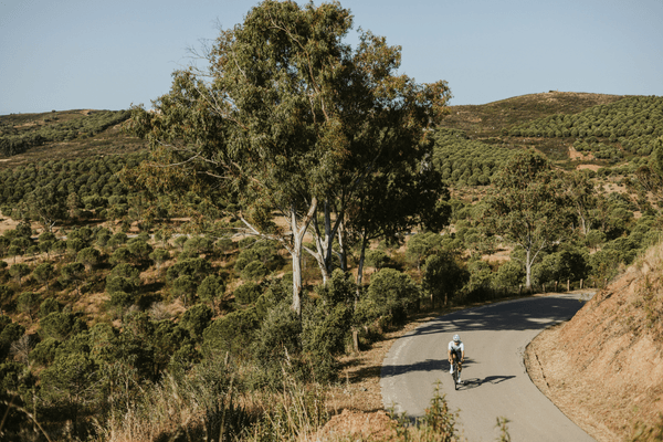
Fóia sits at 902 metres above sea level at the top of the Serra de Monchique, and it is the highest point in the south of Portugal. The radar antennas on the summit are visible from the coastal roads around Portimão and Lagos on clear days. When you spot them from forty kilometres away, you already know where you are going.
This is the one climb in the Algarve that earns the description properly. Not a hill. Not a steady rise through farmland. A genuine summit finish that has separated general classification contenders at the Volta ao Algarve for years – the race where Tadej Pogačar took his first professional win in 2019, where Remco Evenepoel powered to victory in 2020, and where 19-year-old Paul Seixas outsprinted Juan Ayuso and João Almeida on the same road in February 2026. The roads most amateur cyclists ride in February and March are, literally, the same roads those races were decided on.
What You Need to Know About the Fóia Climb Before You Go
The standard Fóia climb from Monchique town is 7.2 to 8.9 kilometres depending on the start point, with an average gradient of around 6.0-7.3% and a summit at 902 metres. Foia is the Algarve’s most famous climb, but not its hardest – that title goes to the considerably steeper Alto do Malhão, the Volta ao Algarve’s other summit finish.
From Portimão, the full ascent from sea level covers approximately 24 kilometres at an average of 3.5%, gaining around 860 metres in total. The road surface is good throughout. Traffic is light above Monchique. No specialist gearing required for the Monchique segment, though a compact chainset helps with cadence.
The Numbers: What Strava and Climbfinder Say
There is some variation in published figures depending on where you start measuring, so it is worth being precise.
The Strava segment “TTH Cafe to Foia Climb” – one of the most-attempted segments on the climb with over 34,000 efforts – runs 7.22 kilometres from the outskirts of Monchique town to the summit, with 520 metres of ascent and an average gradient of 6.0%. This is the segment most riders are targeting when they talk about the Fóia climb as a standalone effort.
Climbfinder lists the full climb from Caldas de Monchique (the thermal spa village 6 kilometres below Monchique) at 16.4 kilometres, 795 metres of ascent, and a 4.9% average – a second-category climb in UCI terms. The steepest section of this longer route averages 11.1%.
For the 2026 Volta ao Algarve, Stage 2 used a partially new route to the summit: 8.9 kilometres at 6.2% average, with two sections described by race organisers as “considerably steeper” and one 1-kilometre section averaging around 9-10% just over 3.5 kilometres from the finish.
BIKE Magazine quotes the Monchique town to summit section at approximately 8 kilometres averaging 7.3%, which aligns with the experience of riders who have done it.
The figure most riders need: starting from Monchique town, expect roughly 7-8 kilometres at an average around 6-7%, gaining 430-520 metres depending on exact start point. Manage effort over the first half and the gradient is consistent enough to hold pace to the top.
From Portimão: the full day out
Starting from Portimão adds significant depth to the ride. For the shortest, most direct version of this approach with full ride stats and a Strava route file, see our Foia Climb from Portimão route page. The route north from the marina covers approximately 32 kilometres to the summit, gaining around 1,000 metres in total.
The lower section – Portimão to Caldas de Monchique – is on the N266, a wider road with more traffic, particularly in the morning. The gradient on this section is moderate, rarely above 4-5%, and gives you legs to burn before the real climbing starts.
Once past Caldas de Monchique the trees close in, the road narrows, and the character changes. Caldas itself is worth noting as a café stop – the village has a handful of places to refuel before committing to the upper section – though many riders push straight through to Monchique town.
Velo Algarve’s Race Road route from Portimão and Up One Side, Down the Other from Portimão map this out with GPX files pre-loaded on the Garmin that comes with every bike delivery.
The Climb Section by Section
Monchique town to Miradouro da Fonte Santa (km 0-4)
The official road for the standard climb is the N266-3, heading west out of Monchique. The first four kilometres are the more consistent section. The gradient sits around 6-7% throughout, the road surface is clean, and you are in the trees. The radar antennas on the summit appear and disappear between the eucalyptus as you gain height. There are no significant ramps in this section, which makes it easier to find a sustainable pace.
The Miradouro da Fonte Santa sits just off the road at roughly the four-kilometre mark. The viewpoint looks south toward the coast, and there is a natural spring here where locals fill bottles. It is a useful reference point for measuring pace on the ascent.
Fonte Santa to the Pomba junction (km 4-6.5)
This is the section where the gradient increases. The road continues to gain steadily, with pitches hitting 8-10% on some bends before easing. The Pomba junction – the start of the Pomba ascent used by the Volta ao Algarve as a categorised intermediate climb – sits at around 6.2 kilometres from the start of the upper section. In the 2021 Volta ao Algarve stage notes, Pomba was described as a 3.6-kilometre ascent averaging 8.2%.
If you are on a loop that takes you over the north side via Portela do Vale or Portela da Nave, these roads diverge from around this point. The north side routes are significantly harder – Climbfinder rates the Portela da Nave approach at 7.4 kilometres averaging 8%, with a maximum gradient of 22% – and are not the road used by most cyclists or by the professional race.
Pomba junction to the summit (km 6.5-8.9)
The final stretch to the summit is the section where races are decided. The 2026 Volta ao Algarve stage had two harder ramps on this approach, with one kilometre averaging around 9-10% at the 3.5-kilometre-to-go mark. For amateur riders on the standard southern approach, the gradient increases as the terrain opens up near the top. The trees thin. The wind arrives. The antennas get closer.
At the summit, the road reaches a large car park, a small chapel (Capela de Santo António), a restaurant, craft and souvenir shops, and the Alecrim Food Truck tucked just below the viewpoint – which serves coffee, drinks, and food with the full 360-degree panorama as a backdrop. In clear conditions the view spans from Faro in the east, to the Costa Vicentina running north, to Cabo de São Vicente and the Sagres peninsula in the west. Serra da Arrábida, more than 200 kilometres north, can be seen on exceptionally clear days. There is a sculpture at the top depicting a cyclist at the moment of summit arrival – modelled on Remco Evenepoel’s 2020 Volta ao Algarve stage win here – installed by the Monchique municipality in recognition of the climb’s significance to cyclists.
The Descent
The descent on the standard southern route via the N266-3 back to Monchique is fast and technical. The road is narrow in sections, the bends are tight, and the surface has some irregular patches. Riders who have done it recommend the same road back rather than the smaller connecting track off the northern side, which includes some loose gravel sections. Control speed on the lower switchbacks. The return from Monchique down to Caldas de Monchique and Portimão is straightforward.
If you are building a loop rather than an out-and-back, the road west from Monchique toward Marmelete and on to Aljezur gives a full western Algarve day with 2,000+ metres of climbing and around 120-150 kilometres from Portimão. Velo Algarve maps the key Benchmark Summit from Monchique and the Down the Race Road from Monchique descent variants with full GPX.
Two Segments Worth Knowing
Not every day at Fóia needs to be the same ride. Brad Dalli, who co-founded Velo Algarve and rides these roads regularly, uses two Strava segments to define the range of what this mountain offers – one for a solid training day, one for when he wants the climb to work harder.
Saida Rasmanho to Fóia – the steady day
Brad’s go-to segment for a solid training effort without overreaching. The Strava segment “Saida Rasmanho – Foia” runs 19.95 kilometres to the summit, gaining 820 metres at an average of 4.1%.
The longer approach and moderate average gradient make this the right segment when the legs are a day or two into a training bloc and you want meaningful climbing metres without spiking TSS. The extended lower section keeps the effort aerobic before the grade increases above Monchique. It is the version of the climb that rewards consistent pacing over raw power – and at just over an hour for a rider at that level, it fits neatly as a morning effort before the group reconvenes for the descent and a lunch stop.
Foz do Farelo to Fóia – the back side
For days when Brad wants the mountain to ask more of him, the Foz do Farelo approach is the segment he reaches for. The Strava segment “Foz do Farelo_Fóia” covers 15.69 kilometres, gaining 717 metres at an average of 4.6%.
This is the backside of the mountain – the approach from the north-west through Foz do Farelo rather than up through Monchique town. Climbfinder records the Foz do Farelo approach at around 15.7 kilometres and 749 metres, which aligns closely with the segment data. What the average gradient does not show is that this line has steeper, more sustained sections in the upper half that make it harder to pace than the southern route. The road is quieter, the surface rougher in places, and there is almost no traffic. On clear days the ride out to Foz do Farelo gives views across the Costa Vicentina before the road turns inland and begins to climb.
This is the segment to use when the standard climb has started to feel familiar and you want to earn the summit differently.
The Café Stop: Velochique in Monchique
Velochique on Rua Serpa Pinto 8 in the centre of Monchique is the stop on the way home after the descent. A cycling-dedicated café and bike shop in the main square, it serves proper espresso, a solid breakfast and lunch menu, and stocks gels, accessories, and workshop support. After the summit and the descent back into Monchique, it is the right place to sit down, eat properly, and let the legs recover before the return to the coast. If anything goes wrong mechanically, this is also the place to sort it. Closed on Tuesdays.
When to Ride
February to April is the window when Fóia is at its best for training. Temperatures at sea level run 14-18°C, the roads carry the winter and early-season training camp traffic that defines professional cycling in the Algarve, and the summit itself is cool rather than cold. Above 700 metres the temperature can be 4-6°C lower than at the coast, so a light gilet or vest for the descent is worth having.
In July and August the summit can be packed with day-trippers by car and coach and the heat makes a midday summit push genuinely uncomfortable. If you are riding in summer, the solution is a morning start from Portimão – on the bike by 07:00, at the summit by 09:30 before the car traffic builds.
September and October are the second window for serious riding here. The light changes, the crowds thin, and the road is at its best.
Frequently Asked Questions
How hard is the Fóia climb?
The standard climb from Monchique town is 7.2 to 8.9 kilometres at an average gradient of 6.0-7.3%, gaining 430-520 metres to the 902-metre summit. It is a sustained effort rather than a brutal one – no exotic gearing required, though a compact chainset helps on the longer approach from Portimão.
What is the best time of year to ride Fóia?
February to April and September to October. The Volta ao Algarve finishes here every February, when conditions are typically near-perfect. In July and August, start by 07:00 from Portimão to reach the summit before the heat and day-tripper traffic build.
How far is the full ride from Portimão?
Approximately 32 kilometres from Portimão to the summit, gaining around 1,000 metres in total – a proper training day from sea level. The lower section to Caldas de Monchique is on the wider N266, with the real climbing beginning past Monchique town.
Is Fóia harder than Alto do Malhão?
No. Fóia is the Algarve’s most famous climb, but Alto do Malhão – the Volta ao Algarve’s other summit finish – is considerably steeper. Fóia rewards consistent pacing over a sustained gradient rather than raw power on short, brutal ramps.
Can I rent a bike for the Fóia climb?
Yes. Velo Algarve delivers annually refreshed carbon road bikes directly to your accommodation anywhere in the western Algarve, pre-fitted with the GPX route loaded and the saddle bag stocked, ready for the climb.
Key Takeaways
- Two Strava segments define the range of this mountain: Saida Rasmanho to Fóia (19.95 km / 820m / 4.1%) is the steady training-day line; Foz do Farelo to Fóia (15.69 km / 717m / 4.6%) is the harder backside approach with more sustained gradients and almost no traffic.
- The Fóia summit is at 902 metres – the highest point in the south of Portugal. The standard climb from Monchique town covers 7.2-8.9 km at around 6.0-7.3% average, gaining 430-520 metres.
- From Portimão the full day out covers approximately 32 km to the summit with around 1,000 metres of climbing – a proper training day from sea level.
- The road surface is good on the standard southern approach (N266-3 from Monchique). The north-side alternatives are significantly harder and not the race road.
- No exotic gearing required for the Monchique segment – the gradient is consistent rather than brutal. A compact chainset (34-28 or 34-30) gives comfort on the longer lower section from Portimão.
- Velochique in Monchique town centre (Rua Serpa Pinto 8) is the stop on the way home after the descent – coffee, food, bike support. Closed Tuesdays.
- The summit has a café, restaurant, and the Alecrim Food Truck with full views. Bring a layer – it runs 4-6°C cooler than the coast, and the wind on the summit is real.
- Best months: February to April and September to October. Morning starts (07:00 from Portimão) in summer to beat the heat and the tourist traffic.
- Stage 2 of the Volta ao Algarve has finished here in multiple editions, including the 2026 race won by 19-year-old Paul Seixas ahead of Juan Ayuso and João Almeida. The amateur road and the race road are the same road.
If you are planning a training bloc around Fóia, Velo Algarve delivers race-ready carbon road bikes to your accommodation anywhere in the western Algarve – Portimão, Lagos, Vilamoura, and beyond – with the GPX routes pre-loaded and the saddle bag stocked. No shop queue. No logistics. Just the road.
Check availability and book here.
For how Foia and the wider Algarve compare to other European training destinations, see our guides to the best cycling destinations in Europe and the best cycling vacations for solo riders – both use this climb as a benchmark.
No Comments