Ride Stats
Distance: 65km | Elevation: 1,500m | Ride time: 3–4 hours | Difficulty: Challenging | Surface: Tarmac
Quick Answer
The Serra’s defining day from the inside. The route does the Foia summit climb first — the Volta ao Algarve road from Monchique to 902m — then a loop of the valley below before finishing back at Velochique. 65km, 1,500m, and the most elevation-per-kilometre of any route on the network. Starting with the summit is the point — fresh legs on the hardest climb, Velochique as the reward at the end.
Quick Overview
- The Summit First: The route climbs straight to Foia at 902m from Monchique — fresh legs, hardest effort first, and the Volta ao Algarve road in the best possible condition
- The Summit: 902m — the highest point in the Algarve, views to both coastlines on a clear day. Take a moment before the descent
- The Valley Loop: After the descent the route takes a loop of the valley below — different roads, different character, and the kilometres that complete the elevation tally before the finish
- Finish — Velochique (Monchique): The route finishes at Velochique — the climb is done, the loop is done, and the stop is properly earned. Sit down, eat well, take your time
- Elevation density: 1,500m in 65km is the highest elevation-to-distance ratio on the network — this is a mountain day, not a mountain approach
- Best season: Year-round from Monchique — the altitude keeps the summit cooler than the coast. The valley loop is better in dry conditions
Summit First — The Serra Done Properly
The Benchmark Summit is the Serra route that makes the most of what Monchique gives you — a base already at 450m, the Foia summit 8km above, and the valley road below that most riders descending from the coast never have time for. The structure is deliberate: climb to the summit first while the legs are fresh, then take the valley loop on the descent side before finishing at Velochique.
At 65km and 1,500m it is the highest elevation density of any route on the network. This is not a day padded with flat kilometres — it is a mountain day that earns every metre. For riders based in Monchique, it is the benchmark. The route they do first to know where they stand.
Route Profile
Leave Monchique heading immediately uphill toward Foia. No warm-up on flat road. The legs are already at altitude and the summit road begins from the town centre.
The Foia Summit — 8km from Monchique
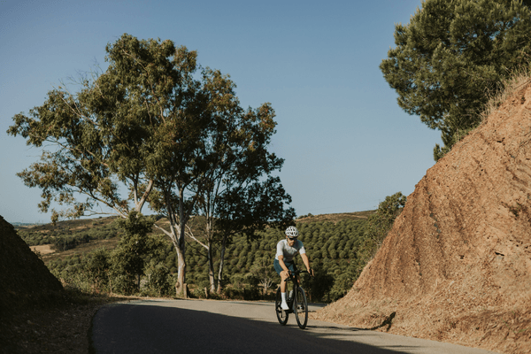
From Monchique the road tilts up immediately and does not relent for 8km. Average gradient 7–8% with sections above 11% in the upper switchbacks. The road surface is smooth throughout. The air cools noticeably as you climb above the tree line. On a clear day the summit at 902m gives views to both coastlines. Take a moment before the descent begins.
The Valley Loop
After the summit descent the route takes a loop of the valley below Monchique — roads through eucalyptus and cork oak with a different character from the main Foia road. This section completes the elevation tally and gives the day variety rather than a simple out-and-back. The loop brings you back into Monchique from below for the finish at Velochique.
Finish — Velochique (Monchique)
The route finishes at Velochique — the summit is done, the valley loop is done, and the stop is properly earned. Sit down, eat something substantial, and take your time. There is no second half of the day still to come. The brunch menu runs through the morning and the café knows what 1,500m of climbing looks like when it walks through the door.
What You Will Need
- Six gels minimum — 1,500m in 65km is concentrated effort that needs consistent fuelling from the first kilometre
- Two full bottles — refill at Velochique at the finish
- A gilet in winter — 902m is considerably cooler than the valley floor in February and March and the descent is exposed
- An early start — the summit climb is best done in the cooler morning hours before the upper section heats up
Best Time to Ride
Year-round from Monchique. The altitude keeps the Serra cooler than the coast in summer, making this a more manageable hot-weather day than the equivalent from the coast. The valley loop is better in dry conditions. In winter the summit is cold and clear — one of the better mountain experiences available anywhere in southern Portugal.
Book the Bike. We Will Handle the Rest.
The Serra’s benchmark day — summit first, valley loop after, Velochique at the finish. Your Cervélo Soloist delivered to Monchique or Silves — pre-fitted, pre-loaded with the route, and ready to ride.
Book your bike with Velo Algarve →
Frequently Asked Questions
Why does this route climb to the summit first rather than warming up on flat roads?
From Monchique there are no flat roads — you are already at 450m and the Foia road begins immediately from the town centre. The structure of the route takes advantage of this: fresh legs on the hardest climb, summit done early, valley loop as the second half. Riders coming from the coast who are used to 25–30km of flat approach before the climb find the Monchique start a different experience entirely.
What is the valley loop section like?
The valley loop below Monchique runs through eucalyptus and cork oak on roads that most riders descending from the coast never see. It has a different character from the main Foia road — quieter, more varied, and with climbing that is less sustained than the summit road. It adds the elevation that makes this day 1,500m in 65km rather than a simple summit out-and-back.
Is Velochique open at the end of the ride?
Velochique opens at 9am Monday to Sunday, closed Tuesdays. For a Benchmark Summit day starting early from Monchique, most riders finish the valley loop and arrive at Velochique between 11am and 1pm — well within the brunch window. Check the day of the week before planning if you want to guarantee the stop.
How does the Benchmark Summit compare to the Foia Corridor routes from the coast?
The Foia Corridor routes from Portimão add 20–30km of flat coastal approach before the summit. The Benchmark Summit starts in Monchique and climbs immediately — giving more elevation per kilometre and a purer mountain day without the coastal transfer. The summit climb itself is the same road. The experience is completely different.
What three routes make up the Serra set?
The Benchmark Summit (Foia summit first then the valley loop, 65km, 1,500m), Down the Race Road (the Volta ao Algarve descent to Portimão and back via the valley, 90km, 1,500m), and The Reservoir Road (connecting Monchique to Silves via the Odelouca dam, 115km, 1,900m). Three completely different days from the same Serra base.
No Comments