

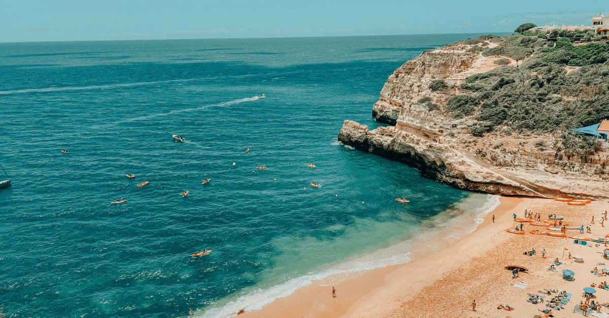
The Algarve’s 155-kilometre coastline is not one thing. It is three quite different coastlines sitting end to end, each shaped by different geology, different exposure to the Atlantic, and a different logic to how you actually reach the water.
The west coast, from Sagres up to Odeceixe, faces the open Atlantic and catches real swell. Beaches here tend to be wide, emptier, and wilder – backed by dark schist and sandstone rather than the golden limestone of the south. The central section, running from Lagos east past Portimão, Carvoeiro and Albufeira to Faro, is the one most people picture when they think of the Algarve: ochre and amber cliffs, small coves carved by millennia of erosion, turquoise water. The east, from Faro to the Spanish border, is different again – the dramatic cliff-and-cove scenery disappears, replaced by the Ria Formosa, a 60-kilometre lagoon system of tidal channels, salt marshes and barrier islands. The beaches here are reached by ferry and feel like a different country from the resort coast to the west.
This guide organises the best beaches by region, so you know what you are actually going to find before you drive there.
What Are the Best Beaches in the Algarve?
The Algarve has over 150 beaches. The best depend entirely on what you want: dramatic cliff scenery and small coves define the central coast around Lagos, Carvoeiro and Albufeira; the western coast near Sagres and Aljezur has wilder surf beaches with far fewer people; the eastern Algarve offers warm, calm lagoon water on barrier islands reached by short ferry crossings from Tavira and Olhão. Praia da Marinha, Praia do Camilo, Praia da Falésia, and Ilha de Tavira regularly appear on best-of lists, each for different reasons.
The Western Algarve: Wild Coast, Bigger Waves, Fewer Crowds
The western coast runs inside the Costa Vicentina Natural Park, which means development is tightly restricted. These beaches are generally quieter than their central Algarve equivalents, more exposed, and better suited to surfers and anyone who prefers the sea to come with some energy. The roads in to reach them are part of the experience – small, often steep, occasionally requiring care at the final approach.
Praia do Beliche – Sagres
Location: 4 km west of Sagres, accessed via a cliff-top car park (free) and a long staircase descent.
Character: A south-facing amphitheatre enclosed by 40-metre cliffs. The cliffs shelter the beach from the north winds that scour the Sagres peninsula, so Beliche is often warm and calm when Sagres itself is windswept. Two adjacent sandy bays, both with ochre and white cliff streaks worth looking at. One beachside restaurant and sunbed rental on site.
Crowds: Light by Algarve standards even in summer. The staircase deters casual visitors and the location west of Sagres gives it a removed feel.
Water: Clear but Atlantic-cold. Swimmers enjoy it; surfers rate it highly when the swell is right.
Best for: Anyone who wants a dramatic clifftop setting without the Sagres wind. Keep a safe distance from the cliff base – rockfall warning signs are there for a reason.
Praia da Arrifana – Aljezur
Location: 12 km west of Aljezur, at the base of high cliffs inside the natural park. Car park at the cliff top, steep road to the beach.
Character: Around 500 metres of sand in a protected bay, flanked by dramatic cliff faces. One of the most consistent surf spots on the western coast – beginner-friendly inside the bay, heavier breaks toward the northern end for experienced surfers. A handful of restaurants and cafés at the cliff top.
Crowds: Popular with surf schools and a regular summer crowd, but the western coast in general stays quieter than the central Algarve.
Water: Exposed to Atlantic swell. Not the beach for calm paddling, but excellent for anyone who wants real sea.
Best for: Surfers and those who want a genuinely wild Atlantic beach with some infrastructure nearby. Worth combining with a visit to Aljezur itself, a town with a Moorish castle above it and a good café scene.
Praia de Odeceixe – Aljezur/Alentejo border
Location: At the mouth of the Seixe River, where the Algarve meets the Alentejo. Village of Odeceixe sits above the beach on the cliff.
Character: A river-cut beach where the Ribeira de Seixe flows into the Atlantic. The river side provides calm water – good for families and anyone who wants to swim without dealing with Atlantic waves. The ocean side delivers proper surf. A genuinely dual-personality beach.
Crowds: Manageable. The village access road is a deterrent to volume tourism.
Best for: A mix of ages or abilities in a group, or anyone arriving from the north who wants the first taste of Portugal’s Atlantic coast.
The roads between Sagres, Aljezur and Odeceixe are among the quietest in Portugal – running through the natural park on smooth tarmac with almost no traffic. Cyclists who rent from Velo Algarve* and base themselves in Lagos use these same roads for training days and long coastal loops. If you are combining a cycling week with a few days on the beach, this stretch of coast covers both.*
The Central Algarve: Cliff-Backed Coves and the Coastline Most People Come to See
The central section of the Algarve coast, from Portimão east through Carvoeiro, Lagoa and Albufeira, is where the limestone cliffs are at their most dramatic and the coves most photogenic. This is the part of the coast that fills the travel posters. The beaches are smaller, the cliff access can involve steep staircases, and parking in peak summer requires an early start.
Praia do Camilo – Lagos
Location: 2 km south of Lagos, off the Estrada de Dona Ana. Free car park at the cliff top; wooden staircase descent to the beach. Arrives in shade in the afternoon.
Character: A small cove framed by golden limestone cliffs, with a rock tunnel connecting two sandy sections. The tunnel is a genuine feature – it takes you through the cliff to a second, slightly less crowded space beyond. One of the most photographed beaches in the Algarve.
Crowds: Heavy in summer from midday onward. Arrive before 10:00 or use the morning light.
Water: Clear, calm, protected from Atlantic swell by the headland.
Best for: Photography, a morning swim, first-time visitors to Lagos. Worth combining with a walk to Ponta da Piedade, 1 km further south along the cliff path.
Praia de Dona Ana – Lagos
Location: 1.8 km south of Lagos old town, walkable in 20 minutes. Car park at the cliff top (around 70 spaces – fills fast in summer). Served by the local tourist train and the blue bus route.
Character: The largest beach along the Ponta da Piedade stretch at 300 metres of shoreline, sheltered by the headland and extended significantly in 2016. Calm water, no currents, excellent for swimming. Full facilities including beach restaurants and showers.
Crowds: Busy from June to September. Morning visits are significantly more comfortable.
Best for: Families with young children, anyone who wants the Lagos cliff scenery with a manageable beach size and full facilities. The old town is a 20-minute walk for lunch.
Praia da Marinha – Lagoa
Location: Between Carvoeiro and Albufeira, near the village of Benagil. Car park at the cliff top; steep staircase descent.
Character: A sheltered cove behind a double limestone sea arch, with sea stacks, natural grottos, and water that sits in extraordinary shades of blue above the sandy bottom. Named by the Michelin Guide as one of the ten finest beaches in Europe. The starting point for the Seven Hanging Valleys Trail – a 6-kilometre coastal walk following the cliff tops west to Praia de Vale Centeanes, past Benagil Cave and the Alfanzina lighthouse.
Crowds: Extreme in summer. The car park on the access road is closed by police once capacity is reached on peak days. Arrive before 09:00 in July and August.
Water: Protected cove, calm and clear. Snorkelling through the sea arch is possible.
Best for: The cliff scenery, the coastal walk, snorkelling. Not the best choice for a relaxed summer afternoon with a book.
Praia da Falésia – Albufeira/Vilamoura
Location: Stretches 6 km from Olhos de Água (Albufeira) to Vilamoura. Multiple access points along the cliff top.
Character: The Algarve’s most dramatic long beach – red and orange cliffs rising up to 40 metres behind a wide strip of golden sand that runs unbroken for 6 kilometres. This is the beach that earns ‘longest cliff-backed beach in Portugal’ descriptions, and it lives up to them. Ranked fifth in the world by TripAdvisor’s Travellers’ Choice in 2025.
Crowds: Significant in summer near the hotel access points, but the sheer length means you can always find space by walking east or west.
Best for: Long walks, anyone staying in Vilamoura or Albufeira who wants a beach that offers space, and those who want the visual drama of the cliffs without the steep staircase approaches of the smaller coves.
Praia da Rocha – Portimão
Location: South of Portimão city centre, 1.5 km from the marina. Bus connections from Portimão. Paid parking near the promenade.
Character: The widest beach in the Algarve at 200 metres deep and over a kilometre long. Backed by high-rise hotels and a lively promenade with restaurants, beach bars, and night-time activity. The Fort of Santa Catarina stands at the eastern end, a 17th-century fortress built to defend the mouth of the Arade River. Rock formations to the west at Praia dos Três Castelos.
Crowds: Significant in summer – this is one of the busiest resort beaches in Portugal. Hosts large music festivals including Afro Nation on the sand.
Best for: Anyone who wants a big beach with full resort infrastructure, nightlife nearby, and good bus access. Not the choice for solitude, but not trying to be.
The Eastern Algarve: Barrier Islands and the Ria Formosa
East of Faro the cliff scenery disappears entirely. The Ria Formosa – a protected lagoon system voted one of Portugal’s seven natural wonders – runs for 60 kilometres toward the Spanish border. The beaches here lie on the seaward side of a chain of barrier islands, separated from the mainland by the lagoon. Reaching them requires a short ferry crossing from the fishing villages along the shore. The water is calmer, often warmer, and the sense of space entirely different from the central Algarve.
Ilha de Tavira – Tavira
Location: Accessible by ferry from Tavira old town (or from Cais das Quatro Águas, which runs year-round). Ferry costs around €1.40 return; last departure from the island around 20:00 in summer.
Character: A 10-kilometre barrier island inside the Ria Formosa Natural Park. The beach faces south-east, sheltering it from Atlantic swell and producing calm, relatively warm water. The area near the ferry landing has a beach bar and basic facilities. Walk ten minutes in either direction and it empties out.
Crowds: The ferry landing area gets busy in peak summer. Fifteen minutes’ walk and the beach is quiet.
Water: Calm, shallow, Blue Flag. The sheltering effect of the lagoon means gentler conditions than any beach on the south coast west of Faro.
Best for: Families with children, anyone who wants to combine a beach day with time in Tavira – one of the most handsome towns in the Algarve. The Roman bridge and the castle gardens above the town are worth the afternoon.
Praia do Barril – Tavira
Location: Near the village of Pedras d’El Rei, east of Tavira. Access via a 1-kilometre boardwalk through the Ria Formosa scrubland, or a short ride on the miniature railway that once transported the tuna catch.
Character: A long sandy beach on the southern edge of a barrier island. The site was a tuna fishing settlement until the 1960s collapse of stocks – a rusting anchor cemetery from that era remains on the beach. Beyond the facilities near the railway terminus, the beach runs empty for several kilometres.
Best for: Those who want a quiet beach with genuine character without a ferry. The anchor field is one of the few genuinely unusual things on any Algarve beach.
Praia de Cacela Velha – Vila Real de Santo António
Location: Below the whitewashed village of Cacela Velha, accessible at low tide by a walk across the lagoon, or by small boat from Sítio da Fábrica. No facilities on the beach.
Character: A broad strip of sand and sea at the eastern end of the Ria Formosa, with no restaurants, no sunbeds, and no shade. The village perched above it has a small Moorish fortress with views across the turquoise lagoon to the barrier islands – one of the finest viewpoints in the eastern Algarve.
Crowds: Near zero. The access keeps it that way.
Best for: Anyone who wants a genuinely empty beach and is happy to carry everything they need. Cacela Velha village itself is worth the stop regardless.
Praia da Manta Rota – Vila Real de Santo António
Location: 10 km west of Monte Gordo, 25 km east of Tavira. Accessed directly from the village – no ferry required. Free parking in the village.
Character: A wide beach where the eastern Algarve’s sheltered position produces water temperatures that reach 22-24°C in summer – noticeably warmer than beaches further west. Portuguese families have been coming here for decades. The restaurant prices reflect a village economy rather than a resort one.
Crowds: Manageable by central Algarve standards. Mostly Portuguese visitors. Arrive before 10:00 in peak season for the best parking.
Best for: Families, anyone who wants warm water, and those looking for a beach where the restaurant lunch costs what it should. Cacela Velha is five minutes by car and worth combining.
Key Takeaways
- The western Algarve (Sagres to Odeceixe) has the wildest beaches with the most space and the strongest surf. Best for those who want fewer crowds and Atlantic character.
- The central Algarve (Lagos to Albufeira) has the postcard cliff-and-cove scenery most visitors come for. Praia da Marinha, Praia do Camilo and Praia da Falésia are the standouts. Arrive early in summer – parking at the popular beaches fills before 10:00.
- The eastern Algarve (Faro to the Spanish border) is defined by the Ria Formosa – barrier island beaches reached by ferry, with calmer and warmer water than the coast to the west. Ilha de Tavira and Praia do Barril are the beaches to know.
- Sea temperature across the Algarve ranges from 15-20°C on the exposed western coast to 22-24°C at Manta Rota in the sheltered east. The difference is significant.
- The Seven Hanging Valleys Trail (6 km, Praia da Marinha to Praia de Vale Centeanes) is the best way to see the central coastline if you are willing to walk. Start at Marinha before 09:00 and walk west.
- A car is necessary for the western coast and most central Algarve beaches. The eastern Algarve can be done by train to Tavira and local ferries.
If the roads connecting these beaches are part of the appeal – and on the western coast and the Monchique foothills they very much are – road bike rental delivered to your accommodation is available across the Algarve from Lagos to Portimão and beyond. The same roads that carry you to the beach in a car are the ones that make the Algarve one of the best cycling destinations in southern Europe.
For more on the Algarve as a destination, our guide to cycling holidays in Portugal covers the broader picture, and our guide to the best beach towns in the Algarve gives more depth on where to base yourself.
No Comments