
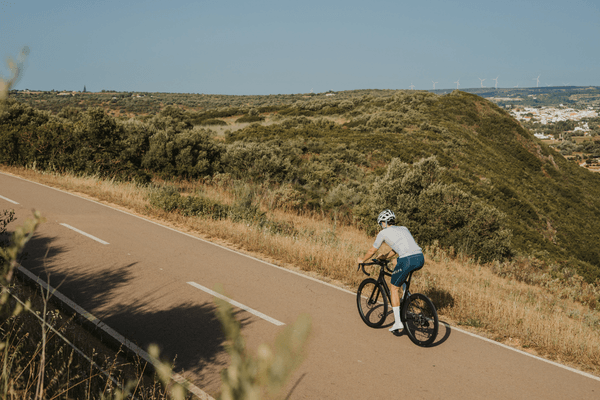
The best cycling routes in Faro run in two very different directions: north into the Serra do Caldeirão, where the climbing builds through Loulé toward Alto do Malhão and the 584-metre high point of the eastern Algarve, and along the coast through the Ria Formosa lagoon toward Olhão, which is as flat as riding in Portugal gets. Faro is the only Algarve base where a proper mountain day and a completely flat recovery spin both start from the same front door.
Most visitors treat Faro as the airport and nothing else, which is exactly why the roads north of it stay quiet. Once past the airport corridor and the N125, the lanes through the Barrocal toward Estoi, Santa Bárbara de Nexe and São Brás de Alportel carry a fraction of the traffic of the resort belt further west.
Key Takeaways
- Faro splits cleanly into two ride types: flat lagoon riding through the Ria Formosa toward Olhão, and serious climbing north through Loulé into the Serra do Caldeirão.
- Alto do Malhão, the Volta ao Algarve’s signature summit finish, is reachable in a long day loop from Faro, around 155 km with roughly 2,200 metres of climbing for the full circuit.
- The Serra do Caldeirão tops out at 584 metres in the eastern Algarve, with the climbing starting in earnest past São Brás de Alportel.
- The Ria Formosa corridor toward Olhão is the flattest genuine route in the region, following the lagoon edge on the Ecovia do Litoral alignment.
- Book a pre-fitted road bike delivered to your Faro accommodation at book a bike here.
Cycling From Faro: What the Terrain Actually Looks Like
Faro sits at sea level between the lagoon and the hills, and the first few kilometres in any direction are flat. The change comes past Estoi and Santa Bárbara de Nexe, where the Barrocal starts tipping upward, and it gets serious past São Brás de Alportel, where the road into the Serra do Caldeirão begins climbing properly through cork oak country toward the 584-metre high point of the eastern Algarve. East along the coast there is no climbing at all, just the lagoon, the salt pans and the fishing towns of the Ria Formosa.
The one stretch to plan around is the airport corridor west of the city, which carries steady traffic year-round. Route out north through Estoi or east toward Olhão and it never becomes part of the ride.
The Best Routes Out of Faro
1. Into the Serra do Caldeirão – São Brás and the High Country
The climbing route, and the reason Faro deserves more credit as a base than it gets. It leaves the city north through Estoi, past the pink Rococo palace, then climbs steadily through São Brás de Alportel into the Serra do Caldeirão, where the cork oak forest closes in and the roads empty out almost completely. The high country tops out at 584 metres, and the descent back south through the Barrocal is long, fast and quiet. Expect 80 to 100 km with well over 1,200 metres of climbing depending on the turnaround. This is the full Into the Serra do Caldeirão route, loaded as GPX on every rental.
2. The Volta Roads – Loulé, Salir and Alto do Malhão
The route for anyone who watches the Volta ao Algarve every February and wants to ride what the professionals race. It runs northwest to Loulé, then into the hills through Tôr and Querença toward Salir, before the main event: Alto do Malhão, 2.6 km at an average of 9.8% with ramps near 20%, the race’s signature summit finish. The full loop from Faro runs to roughly 155 km with around 2,200 metres of climbing, though shorter versions turning at Salir still take in the best of the Barrocal. This is the full Volta Roads route, with the climb segments marked on the Garmin.
3. The Lagoon Corridor – Ria Formosa and Olhão
The flat one, and the right first ride after landing. It follows the edge of the Ria Formosa Natural Park east toward Olhão, past salt pans, tidal flats and the working fishing harbour, on the alignment of the Ecovia do Litoral. Distance is around 40 km round trip with essentially zero elevation, making it the recovery day, the arrival-day spin, or the ride for the one member of the group who wants flamingos rather than gradients. Olhão’s market halls on the waterfront are the natural turnaround and coffee stop. This is the full Lagoon Corridor route, also loaded on every rental.
Cafe Stops and Practical Notes
- Faro old town, inside the Arco da Vila – the regroup point before or after any route, with cafes around the marina and the cathedral square.
- São Brás de Alportel main square – the last proper stop before the Serra do Caldeirão climbing starts, and the natural refuel on the way back down.
- Loulé market building – the standard mid-ride stop on the Volta Roads route, busiest on Saturday mornings when the market is running.
- Olhão waterfront market halls – the turnaround stop on the Lagoon Corridor, with cafes facing the fishing harbour.
Parking for support vehicles is easiest at the Faro marina or the Largo de São Francisco car park by the old town. Phone signal drops in patches through the Serra do Caldeirão north of São Brás, so download the GPX before setting out rather than relying on live navigation. For where to actually stop for coffee before or after any of these rides, best cycling cafes faro covers the spots worth knowing around the old town and marina.
Faro anchors the eastern end of our central Algarve coverage, with Loulé sharing the same route group for anyone staying inland. Moving west along the coast, cycling routes vilamoura covers the resort corridor, cycling routes albufeira covers the Alte climbs, and cycling routes lagos covers the western Algarve for anyone splitting a trip across both ends of the region.
Frequently Asked Questions
What are the best cycling routes near Faro?
The three best routes from Faro are the climb north into the Serra do Caldeirão through São Brás de Alportel, the Volta Roads loop through Loulé and Salir to Alto do Malhão, and the flat Lagoon Corridor along the Ria Formosa to Olhão. Between them they cover the region’s hardest climbing and its flattest riding, both starting in the city.
What do you need to know about cycling routes Faro before you go?
Route north through Estoi or east toward Olhão to avoid the airport corridor, which carries the only heavy traffic near the city. The climbing starts past São Brás de Alportel rather than at the coast, and phone signal drops in the Serra do Caldeirão, so download GPX files before setting out.
Can you ride Alto do Malhão from Faro in one day?
Yes, but it is a big day. The full loop through Loulé, Salir and Alto do Malhão runs to roughly 155 km with around 2,200 metres of climbing, and the climb itself is 2.6 km at an average of 9.8%. Turning at Salir instead gives a shorter day that still covers the best of the Barrocal.
Is Faro good for flat cycling as well as climbing?
Yes, better than anywhere else in the Algarve. The Lagoon Corridor along the Ria Formosa toward Olhão is essentially flat for its full length, around 40 km round trip, while the Serra do Caldeirão climbs sit within a morning’s ride north. No other Algarve base puts both extremes this close together.
Riding These Roads on the Right Bike
Every route above is one we ride and load as GPX onto the Garmin that comes with every rental. Faro is where most of our customers land, and delivery to the city means the bike can be at your accommodation, fitted and ready, on the day you arrive rather than after a transfer west. Check delivery to your address on the Faro location page.
Rent a Bike in Faro: book a bike here and start riding the day you land, with routes loaded and nothing to build.
No Comments