

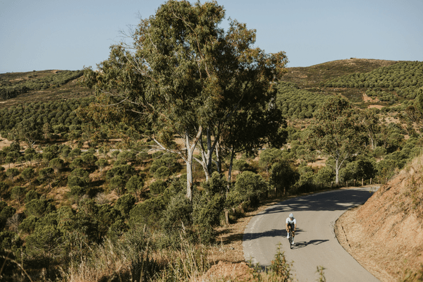
Cycling routes in Carvoeiro split three ways: east along the clifftops toward Benagil and Armação de Pêra, north through the Barrocal to the Moorish castle at Silves, and a longer inland push toward Alte and the hardest climbing in the central Algarve. Carvoeiro’s advantage over the bigger resort bases is that the best coastal riding starts at the door rather than 20 kilometres away, and the clifftop lanes carry a fraction of the traffic on the N125 just inland.
Key Takeaways
- Silves sits roughly 15 km north of Carvoeiro by road, making the castle ride the most accessible genuine destination from the town.
- The Benagil descent and the climb back out are genuinely steep, short but sharp enough that riders coming from the flat coast road notice them.
- Alto do Malhão, the closing climb of the Volta ao Algarve, is 2.6 km at an average of 9.8%, the steepest regular ascent in the central Algarve.
- A full Carvoeiro coast and Silves loop runs to roughly 73 km with 450 to 660 metres of climbing, depending on the return road you take.
- Average delivery time to Carvoeiro addresses from our Lagos base runs to around 40 minutes.
Cycling From Carvoeiro: What the Terrain Actually Looks Like
Carvoeiro sits on the cliffs in Lagoa municipality, which sets the pattern for every ride out of town. Head east and the road rolls hard along the clifftop, dipping into coves like Benagil and climbing straight back out, short efforts rather than sustained ones. Head north and the land rises gently through Lagoa and Estômbar into the Barrocal, the limestone hill country between the coast and the Serra do Caldeirão, on quiet farm roads through citrus groves.
The traffic pattern is worth knowing. The N125 runs east to west a few kilometres inland and carries most of the through traffic, which means the coastal lanes either side of Carvoeiro stay comparatively quiet even in season. The road north to Estômbar is a genuinely pleasant, quiet stretch, and the rural roads beyond Lagoa toward Silves carry very little.
The Best Cycling Routes Near Carvoeiro
1. The Clifftop Corridor – Carvoeiro to Armação de Pêra
The route Carvoeiro exists for, and the one that starts at the door rather than after a transfer. It runs east from Carvoeiro past the Alfanzina lighthouse, along lanes hugging the cliff edge rather than the N125, through Benagil and Praia da Marinha toward Armação de Pêra. The Benagil section is the sting: a short, steep descent into the village and an equally steep climb straight back out, sharp enough to surprise anyone treating this as a flat coastal spin.
Past Armação, a short climb leads to the Senhora da Rocha viewpoint, looking straight down over the cliffs and out to the Atlantic. Round trip from Carvoeiro comes to roughly 35 to 40 km, rolling throughout. This is the full Clifftop Corridor route, with the viewpoint and the Algar de Benagil sea cave marked as photo stops on the GPX.
2. The Moorish Capital – Carvoeiro to Silves
The history ride, and the easiest genuine destination from Carvoeiro. It heads north through Lagoa and Estômbar on quiet rural roads, climbing gently with views over the Arade river and the Serra beyond, to Silves and its 11th century red sandstone castle, the old Moorish capital of the Algarve.
Distance is around 15 km each way, mostly flat to gently rolling, which makes it a comfortable half day for a mixed-ability group. Ridden as a fuller loop taking in the coast on the return through Ferragudo and Lagoa, it comes to roughly 73 km with 450 to 660 metres of climbing depending on the roads chosen. This is the full Moorish Capital route, loaded as GPX on every rental.
3. The Wall and the Summit – Alte and Alto do Malhão
The route for riders who came to climb. From Carvoeiro it is a longer proposition than from bases further east, running north through Silves and São Bartolomeu de Messines into the hill country around Alte, one of the prettiest villages in the Algarve and the natural coffee stop before the terrain turns serious.
Just beyond Alte, the road kicks into the Wall of Alte, 2 km averaging 7.4%. Further north, Alto do Malhão climbs 2.6 km at an average of 9.8%, the closing climb of the Volta ao Algarve and the steepest regular ascent in the region. Expect a full day and well over 1,200 metres of climbing from Carvoeiro. This is the full Wall and the Summit route, also loaded as GPX on every rental.
Cafe Stops and Practical Notes
- Silves, by the Roman bridge and the castle walls, is the natural break on the Moorish Capital route, with cafes looking straight onto the fortifications.
- Alte village square is the last realistic refuel before the Wall of Alte, and the only sensible stop on that route before the gradient bites.
- Armação de Pêra promenade works as the turnaround point on the Clifftop Corridor, or as a halfway stop if you continue toward Albufeira.
- Carvoeiro marina front is the easiest regroup point for a group setting out, with parking for a support vehicle nearby.
Parking for a support vehicle is easiest at Carvoeiro itself or in the main car park below Silves castle. Signal drops out in sections of the Barrocal north of Messines, so download the GPX before setting out rather than relying on live navigation.
Nearby locations in the same route group are worth knowing about for anyone splitting a trip across the central coast: Lagoa and Armação de Pêra for shorter loops, cycling routes albufeira to the east for the same climbs from a different angle, and Portimão to the west for the Fóia climb through Monchique.
Frequently Asked Questions
What do you need to know about cycling routes Carvoeiro before you go?
The coastal riding starts immediately, which is Carvoeiro’s main advantage as a base. The clifftop lanes east toward Benagil roll harder than they look, with short steep pitches in and out of the coves. Keep off the N125 where possible, since the parallel lanes carry a fraction of the traffic and most of the scenery.
What are the best cycling routes near Carvoeiro?
The three best routes near Carvoeiro are the Clifftop Corridor east past Benagil to Armação de Pêra, the Moorish Capital ride north to Silves castle, and the longer Wall and the Summit loop to Alte and Alto do Malhão. Between them, riders get rolling coastal lanes, an easy history destination, and the region’s hardest climbing.
How far is Silves from Carvoeiro by bike?
Around 15 km each way on quiet rural roads through Lagoa and Estômbar, gently rolling rather than flat. Ridden as a fuller coastal loop returning through Ferragudo, the same route extends to roughly 73 km with 450 to 660 metres of climbing, which suits a group wanting a full day rather than a half.
Is the Benagil section hard on a road bike?
It is short but genuinely steep in both directions. The descent into Benagil and the climb back out are the sharpest efforts on the Clifftop Corridor route, and they catch out riders expecting a flat coastal spin. Nothing technical, just a pair of brief, steep pitches worth saving something for.
Riding These Roads on the Right Bike
Every route above is one we ride ourselves and load as GPX onto the Garmin that comes with every rental. The clifftop lanes reward a bike that changes direction well, and Alto do Malhão rewards one you trust on a 10% ramp. Check delivery to your Carvoeiro address on the Carvoeiro location page [LINK TO /locations/bike-rental-carvoeiro/ – NOT YET BUILT], and anyone riding elsewhere in the region should see our guides to cycling routes sagres and cycling routes vale do lobo.
Rent a Bike in Carvoeiro: book a bike here and have it waiting at your door, fitted and loaded with routes, before you land.
No Comments