
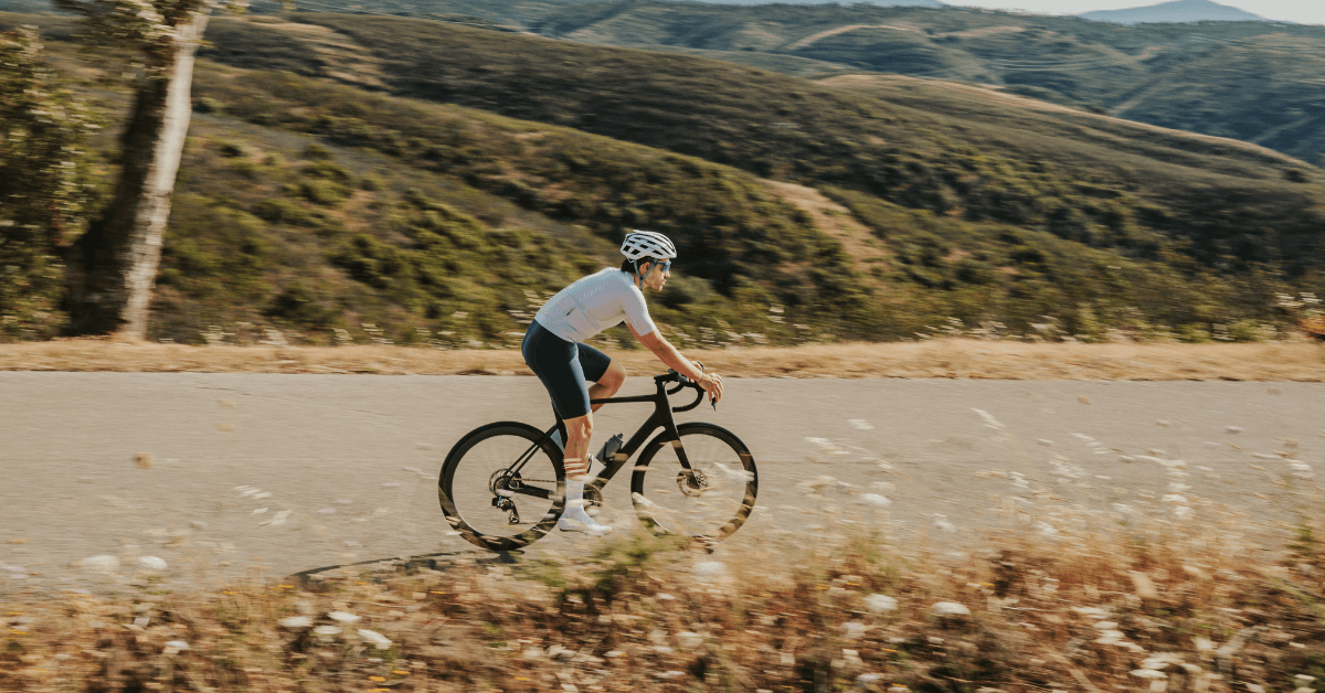
The best cycling routes in Sagres run in three directions from a town that sits almost at the end of the road: 6 km west to Cabo de São Vicente and the lighthouse, north up the Costa Vicentina toward Carrapateira and Aljezur, and east along the coast to Lagos on a 70 km run through Salema and Burgau. There is no fourth direction, because the fourth direction is the Atlantic.
That geography is the whole story of riding here. Sagres is the most exposed base in the Algarve, with almost no shelter and a wind that decides what kind of day you are going to have. Get the direction right and it is the best riding in the region. Get it wrong and the last 20 km take as long as the first 50.
Key Takeaways
- Cabo de São Vicente sits 6 km west of Sagres and is reached on a dedicated cycle path opened in March 2025, so the final stretch no longer shares the road with tourist traffic.
- Wind matters more than gradient here. The afternoon nortada blows from the north-west, which means riding north or west into it and returning with it behind.
- Sagres to Lagos along the coast is roughly 70 km round trip through Salema, Burgau and Luz, the region’s best-known coastal ride.
- Torre de Aspa, 5 km north of Vila do Bispo, is the highest point on the entire Algarve coastline at around 156 metres.
- Book a pre-fitted road bike delivered to your Sagres accommodation at book a bike here.
Cycling From Sagres: What the Terrain Actually Looks Like
Sagres sits on a low headland above Baleeira harbour, and nothing around it is steep. The riding is rolling rather than mountainous, with the land rising gently inland toward Vila do Bispo and the ridge at Torre de Aspa, then dropping back to the coast in a series of short valleys running east toward Salema and Burgau. There is no climb here on the scale of Foia or Picota. The effort comes from exposure and repetition, not gradient.
What replaces climbing is wind. Sagres sits at the corner where the south coast meets the west coast, and the whole area is inside the Parque Natural do Sudoeste Alentejano e Costa Vicentina, which means low vegetation, few trees and nothing to break the airflow. The nortada, the summer north-westerly, builds through the morning and peaks mid to late afternoon. Every route below should be planned around that rather than around the profile.
The Best Routes Out of Sagres
1. Land’s End – Sagres to Cabo de São Vicente
The shortest route and the one nobody skips. It runs 6 km west from Sagres to Cabo de São Vicente, the south-westernmost point of mainland Europe, on a dedicated cycle path opened in March 2025 as part of the EuroVelo 1 alignment, which took the final stretch off the road shared with coach traffic. Loop it via the Sagres Fortress and the road above Praia do Beliche and the ride comes to around 25 km with about 200 metres of climbing. Wind at the lighthouse is a genuine factor, so keep a hand free on the bars near the cliff barriers. This is the full Land’s End route, loaded as GPX on every rental.
2. The Protected Coast – North to Carrapateira and Aljezur
The wild one. It heads north out of Vila do Bispo into the Costa Vicentina, past Carrapateira and the surf beaches at Bordeira and Amado, on roads that carry almost no traffic and hold the emptiest coastal riding in Portugal. The stretch between Vila do Bispo and Raposeira is a favourite locally, two kilometres of near-perfect surface through green hills. Push on to Aljezur and the round trip runs to 90 km or more. Ride north early while the wind is still light, because coming home into a full nortada is a different ride entirely. This is the full Protected Coast route, also loaded on the Garmin.
3. Lighthouse to Lagos – The Coastal Run East
The classic, and the best introduction to the western Algarve. It runs east from Sagres through Raposeira and Budens, then picks up the coast through Salema, Burgau and Praia da Luz into Lagos marina, roughly 70 km round trip on rolling terrain with short, punchy ramps dropping into and climbing out of each village. Salema is the natural coffee stop on the way out, Burgau on the way back. Riding east in the morning means the nortada is a tailwind home, which is the single best piece of planning advice for this route. This is the full Lighthouse to Lagos route, with the village stops marked.
Cafe Stops and Practical Notes
- Mareta Beach, Sagres – cafes above the beach and the easiest regroup point before or after any route, open early.
- Vila do Bispo main square – the last proper services before the cape or the run north, with Aumol Café the local pick and a supermarket for restocking.
- Salema seafront – the standard stop on the eastern run, cafes by the fishing boats at the bottom of a sharp descent.
- Carrapateira – the only reliable stop between Vila do Bispo and Aljezur, so treat it as the halfway point on the Protected Coast route.
Parking for support vehicles is straightforward at the Sagres Fortress car park or the main lighthouse car park at the cape. Water is the thing to plan properly: fill up in Vila do Bispo or Sagres before heading out, because the cape has only seasonal stalls and the Costa Vicentina north of Carrapateira has nothing at all.
Sagres anchors the western end of our coverage, sharing the Wild West Coast route group with Salema and Aljezur. Moving east, cycling routes portimao covers the Monchique approach, cycling routes albufeira covers the central climbs through Alte, and cycling routes faro covers the eastern end for anyone riding across the region.
Frequently Asked Questions
What are the best cycling routes near Sagres?
The three best routes from Sagres are the short Land’s End loop west to Cabo de São Vicente, the Protected Coast run north through Carrapateira toward Aljezur, and the Lighthouse to Lagos coastal route east through Salema and Burgau. Between them they cover a 25 km spin, a 90 km wild-coast day and the region’s best-known 70 km coastal ride.
What do you need to know about cycling routes Sagres before you go?
Plan around wind rather than gradient. The afternoon nortada blows from the north-west, so ride north or west early and return with it behind you. Fill bottles in Vila do Bispo or Sagres, since the cape has only seasonal stalls and there is nothing north of Carrapateira.
Is there much climbing around Sagres?
No, not by Algarve standards. The terrain is rolling rather than mountainous, with short punchy ramps between coastal villages rather than sustained ascents. Torre de Aspa near Vila do Bispo is the highest point on the entire Algarve coastline at around 156 metres, which puts the scale in context against Foia at 902 metres.
How far is it from Sagres to Cabo de São Vicente by bike?
Six kilometres each way, on a dedicated cycle path opened in March 2025 that runs separately from the main road. Looping it via the Sagres Fortress makes a ride of around 25 km with roughly 200 metres of climbing, which is the shortest genuine route from the town.
Riding These Roads on the Right Bike
Every route above is one we ride and load as GPX onto the Garmin that comes with every rental. Sagres is the furthest west we deliver, about 50 minutes from our base in Lagos, and it is worth having the right gearing and a stocked saddle bag out here given how few services sit between the villages. Check delivery to your address on the Sagres location page.
Rent a Bike in Sagres: book a bike here and have it waiting at your door, fitted and loaded with routes, before you land.
No Comments