

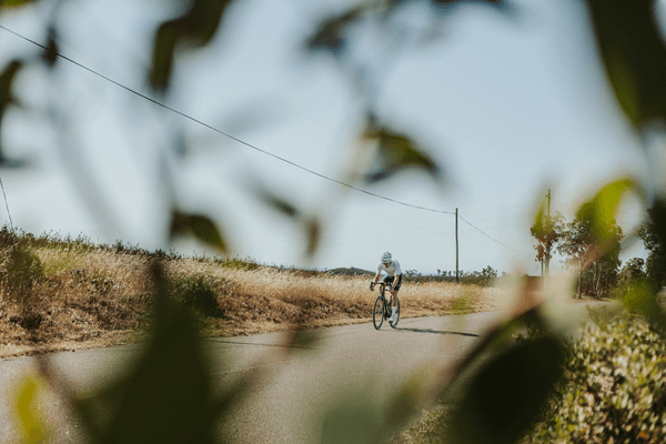
Cycling routes in Albufeira split into three directions: inland toward the climbing terrain around Alte and Salir, north to the Moorish castle at Silves through the Barrocal, and east along the clifftops toward Carvoeiro and Armação de Pêra. Between them you get the toughest climbing the central Algarve offers, a genuine history stop, and a coastal ride with none of the flat monotony of the beachfront strip.
Albufeira gets treated as a resort town first and a cycling base second, which undersells it. The roads inland are some of the same ones the Volta ao Algarve uses every February, and the coast either side of town has enough climbing and quiet lanes to fill a week without repeating a route.
Key Takeaways
- The Wall of Alte is a 2 km climb averaging 7.4%, and the Alto do Malhão summit further north is 2.6 km at an average of 9.8%, the steepest regular climb in the central Algarve.
- Silves castle is roughly 16 km from Albufeira through the Barrocal on quiet roads through Algoz, past orange groves rather than resort traffic.
- The coastal route to Carvoeiro and Armação de Pêra runs to around 40 km round trip, with a short climb to the Senhora da Rocha viewpoint as the highlight.
- Average delivery time to Albufeira addresses from our Lagos base runs to around 50 minutes, the longest of any town on our central coast route group.
- Book a pre-fitted road bike delivered to your Albufeira accommodation at book a bike here.
Cycling From Albufeira: What the Terrain Actually Looks Like
Albufeira sits on the coast at close to sea level, so every route starts flat through the edges of town before the terrain declares itself. Head north and the land rises steadily through Guia and Ferreiras toward Algoz, then climbs properly once you’re past São Bartolomeu de Messines and into the Barrocal, the limestone hill country that separates the coast from the Serra do Caldeirão. Head east along the coast and the roads roll rather than climb, tracing the cliffs toward Armação de Pêra and Carvoeiro.
Traffic is the one thing to plan around. Albufeira itself is busy year-round, and the roads out toward Algoz carry resort traffic until you clear Ferreiras. Once you’re past that stretch, the Barrocal roads carry a fraction of the cars and most of the actual scenery.
The Best Routes Out of Albufeira
1. The Wall and the Summit – Alte and Alto do Malhão
The route serious climbers ask for. It runs north through Boliqueime and Paderne into the hill country around Alte, one of the prettiest villages in the Algarve and a natural coffee stop before the terrain turns serious. Just beyond the village, the road kicks up into the Wall of Alte, a 2 km climb averaging 7.4% that empties the legs before the real test. Further north, the road climbs to Alto do Malhão, 2.6 km at an average of 9.8%, the closing climb of the Volta ao Algarve and the steepest regular ascent in the region. Round trip from Albufeira runs to roughly 75 km with well over 1,200 metres of elevation gain. This is the full Wall and the Summit route, loaded as GPX on every rental.
2. The Moorish Capital – Albufeira to Silves
A ride built around history rather than gradient. It heads north through Ferreiras and Algoz on quiet roads through the Barrocal, past orange groves and small farms, to Silves, the old Moorish capital of the Algarve and home to a red sandstone castle that dates to the 11th century. Distance from Albufeira is around 16 km each way, mostly flat to gently rolling, making this an easy half-day out even for a group that wants a history stop rather than a training ride. This is the full Moorish Capital route, also loaded as GPX on every rental.
3. The Clifftop Corridor – Carvoeiro and Armação de Pêra
The coastal option, and the one to choose when a group wants scenery over suffering. It runs east out of Albufeira toward Armação de Pêra, then on through Lagoa toward Carvoeiro on lanes that stay close to the cliff edge rather than the N125. Past Carvoeiro, a short climb leads to the Senhora da Rocha viewpoint, looking straight down over the cliffs and out to the Atlantic, close to the Algar de Benagil sea cave. Round trip from Albufeira comes to roughly 40 km, rolling rather than flat, with the climb to Senhora da Rocha the only real effort on the ride. This is the full Clifftop Corridor route, with the viewpoint and cave marked as photo stops on the GPX.
Cafe Stops and Practical Notes
- Alte village centre – the standard stop before the Wall of Alte climb, with a couple of cafes on the main square and a river to cool off in afterward.
- Silves, by the castle walls – cafes with a direct view of the fortifications, the natural break point on the Moorish Capital route.
- Carvoeiro marina front – the easiest regroup point on the Clifftop Corridor route, with parking for support vehicles nearby.
- Armação de Pêra promenade – a flatter, earlier stop for anyone splitting the coastal route into two shorter loops.
For a longer list of where to stop and what to order, see the full guide to the best cycling cafes in Albufeira.
Parking for a support vehicle is easiest at the Albufeira marina or at the main car park in Silves below the castle. The Wall and the Summit route loses phone signal in sections around Salir, so download the GPX before setting out rather than relying on live navigation.
Nearby locations in the same route group are worth knowing about for anyone splitting a trip across the central coast: Armação de Pêra, Lagos to the west if you’re staying across both towns, and Carvoeiro and Lagoa for shorter coastal loops of their own. Staying in Vilamoura instead, check delivery there on the Vilamoura location page.
Frequently Asked Questions
What are the best cycling routes near Albufeira?
The three best routes near Albufeira are the climbing loop through Alte and Alto do Malhão, the ride north to Silves castle through the Barrocal, and the coastal route east to Carvoeiro past Armação de Pêra. Between them, riders get the region’s hardest climbing, a genuine history stop, and a rolling coastal ride, all starting directly from central Albufeira.
What do you need to know about cycling routes Albufeira before you go?
Traffic around Albufeira itself is heavy year-round, so the first few kilometres out of town toward Ferreiras are the least enjoyable part of any route. Clear that stretch and the Barrocal and coastal roads carry a fraction of the traffic. Download GPX files in advance, since signal drops out in the hills around Salir.
How hard is the Alto do Malhão climb?
Alto do Malhão is short but genuinely hard, 2.6 km at an average gradient of 9.8% with steeper ramps inside that. It is the closing climb of the Volta ao Algarve and the toughest regular ascent in the central Algarve, more demanding per kilometre than the longer climbs around Monchique to the west.
Is the ride to Silves suitable for a less experienced group?
Yes, the ride to Silves is one of the easier routes out of Albufeira. At around 16 km each way on mostly flat to gently rolling roads through the Barrocal, it suits a mixed-ability group that wants a genuine destination and a castle to look around rather than a demanding day of climbing.
Riding These Roads on the Right Bike
Every route above is one we ride ourselves and load as GPX onto the Garmin that comes with every rental. Groups training through the central Algarve before the Volta ao Algarve each February use the Wall and the Summit route as a benchmark, and it’s worth riding on a bike you trust on a 9.8% ramp. See the full fleet spec for what’s available, or check delivery to your Albufeira address on the Albufeira location page.
Rent a Bike in Albufeira: book a bike here and have it waiting at your door, fitted and loaded with routes, before you land.
No Comments