
The best cycling routes in Loulé have one advantage no coastal base in the Algarve can match: the climbing starts at the town boundary. Ride north from Loulé and you are into the Barrocal within minutes, climbing through Querença and Tôr toward Salir at 225 metres, Alto do Malhão at 501 metres and Barranco do Velho at 500 metres on the old N2. There is no 20 km of flat coastal transit to ride through first.
That is the whole case for basing a trip here rather than on the beach. Loulé is the Algarve’s largest municipality, and almost all of the region’s serious climbing sits inside it: Salir, Querença, Alte, Benafim, Rocha da Pena and the Malhão summit the Volta ao Algarve finishes on every February.
Key Takeaways
- Loulé sits inland in the Barrocal foothills, so climbing begins immediately rather than after a coastal transit like every other central Algarve base.
- Alto do Malhão, 2.6 km at an average of 9.8% to a 501-metre summit, is inside Loulé municipality and is the Volta ao Algarve’s regular summit finish.
- Salir sits at 225 metres and Barranco do Velho at 500 metres on the old N2, the original main road from the Algarve to Lisbon.
- Komoot rates the Loulé road network 4.5 stars across more than 100 reviews and lists close to 100 routes classed as difficult.
- Book a pre-fitted road bike delivered to your Loulé accommodation at book a bike here.
Cycling From Loulé: What the Terrain Actually Looks Like
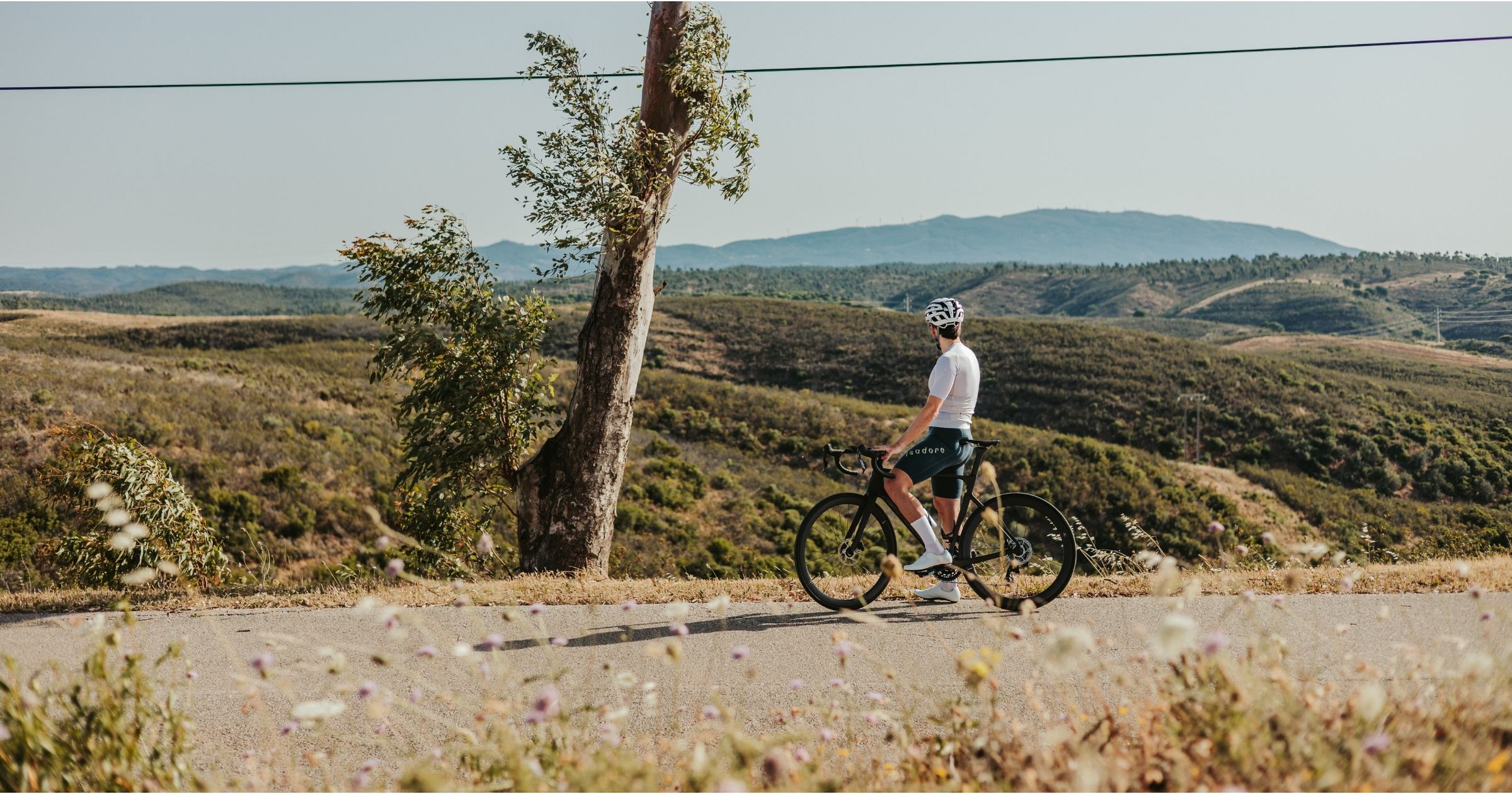
Loulé sits roughly 18 km inland from the coast, already on rising ground, with the Barrocal starting where the town ends. The Barrocal is the limestone belt between the coastal plain and the Serra do Caldeirão, and it is genuinely good riding country: orange and olive groves, karst outcrops, dry-stone walls and roads that go up and down constantly without ever settling into a long steady gradient.
Push further north and the Barrocal gives way to the Serra do Caldeirão proper, where cork oak forest closes in and the roads empty almost entirely. Salir at 225 metres is the gateway, and beyond it the N2 climbs to Barranco do Velho at 500 metres.
The one direction that costs you effort is downhill. Reaching the flat coastal riding around the Ria Formosa means descending to Faro or Almancil first, which is the inverse of the problem every beach base has. If your week is mostly recovery spins, Loulé is the wrong base. If it is mostly climbing, nothing else comes close.
The Best Routes Out of Loulé
1. The Volta Roads – Querença, Salir and Alto do Malhão
The signature route, and it starts from your door rather than an hour up the road. It runs north through Tôr, where a steep pitch out of the Algibre valley wakes the legs up, then on to the hilltop village of Querença, the natural coffee stop, and up to Salir at 225 metres. From there the route builds toward Alto do Malhão, 2.6 km at an average of 9.8% with ramps close to 20%, the climb the Volta ao Algarve finishes on. From Loulé this is a 70 to 90 km day depending on the loop you take back. This is the full Volta Roads route, loaded as GPX on every rental.
2. Into the Serra do Caldeirão – Barranco do Velho and the N2
The high country route, and the quietest riding in the central Algarve. It heads north-east through São Brás de Alportel and picks up the N2, the original Lisbon road, climbing steadily to Barranco do Velho at 500 metres. The descent back south through the cork oak forest is long, fast and almost traffic-free, and the ridge road holds height for far longer than the profile suggests. Expect 80 to 100 km with well over 1,200 metres of climbing. This is the full Into the Serra do Caldeirão route, also loaded on the Garmin.
3. The Lagoon Corridor – Down to the Ria Formosa
The recovery option, and the one that runs the other way. From Loulé you descend south through Almancil to the coast, then pick up the flat lagoon edges of the Ria Formosa Natural Park toward Faro and Olhão on the Ecovia do Litoral alignment. The riding itself is entirely flat, though getting home means climbing back inland at the end rather than at the start. Around 60 to 70 km round trip from Loulé, and the right call the day after Malhão. This is the full Lagoon Corridor route, with the boardwalk sections marked.
Cafe Stops and Practical Notes
- Loulé market building – the regroup point before or after any route, busiest and best on Saturday mornings when the market is running.
- Querença village square – the classic mid-ride stop on the Volta Roads route, a hilltop village with coffee and a long view back toward the coast.
- Bike Café Germano, near Alte – a cyclists’ café out in the orange groves, and the only stop of its kind on the western side of the Barrocal.
- Salir – the last proper services before the Serra do Caldeirão, so fill bottles here rather than assuming something appears higher up.
Parking for support vehicles is easiest around the market or below Loulé Castle, which is a National Monument and worth the two minutes if you are waiting for the group. Phone signal drops in patches through the Serra north of Querença and again around Barranco do Velho, so download the GPX before setting out rather than relying on live navigation.
Loulé shares the Rising Roads route group with Faro, and the two bases suit opposite weeks. Cycling routes faro covers the same network from the coast. Along the coast west, cycling routes vale do lobo covers the Golden Triangle and cycling routes carvoeiro covers the clifftop roads further west again.
Frequently Asked Questions
What are the best cycling routes near Loulé?
The three best routes from Loulé are the Volta Roads loop north through Querença and Salir to Alto do Malhão, the Serra do Caldeirão route up the old N2 to Barranco do Velho at 500 metres, and the Lagoon Corridor descent south to the flat Ria Formosa riding. Between them they cover the region’s hardest climbing and its easiest recovery day.
What do you need to know about cycling routes Loulé before you go?
Climbing starts immediately, since Loulé sits inland in the Barrocal rather than on the coast. That makes it the strongest base in the region for a climbing week and the weakest for flat recovery rides, which require descending to the coast first. Download GPX files, as signal drops north of Querença.
Is Loulé a better cycling base than the coastal resorts?
For climbing, yes. Every coastal base costs 15 to 25 km of flat riding before the gradient starts, while from Loulé the Barrocal begins at the town boundary. The trade-off is that flat recovery riding means descending to the coast and climbing home, so it suits training weeks more than mixed-ability groups.
How hard is the climb to Alto do Malhão from Loulé?
The climb itself is 2.6 km at an average of 9.8% with ramps approaching 20%, making it the steepest regular ascent in the central Algarve. Reaching it from Loulé via Querença and Salir makes a 70 to 90 km day with substantial climbing through the Barrocal before the summit even begins.
Riding These Roads on the Right Bike
Every route above is one we ride and load as GPX onto the Garmin that comes with every rental. Loulé is where we send riders who tell us the trip is about climbing rather than coastline, and the gearing conversation at check-in matters more here than anywhere else we deliver. Check delivery to your address on the Loulé location page.
Rent a Bike in Loulé: book a bike here and have it waiting at your door, fitted and loaded with routes, before you land.
No Comments