
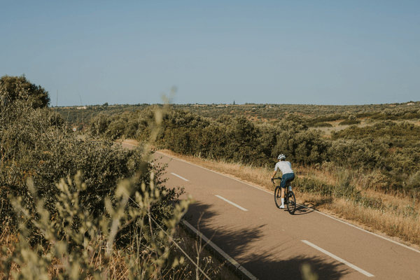
The western Algarve is the part of Portugal where the road actually runs out. Not just quiets down – runs out. At Cabo de São Vicente, six kilometres west of Sagres, the tarmac ends at a clifftop lighthouse and there is nothing but Atlantic in every direction until North America. Riding to that point, from Lagos, through Vila do Bispo, or north through Aljezur with the Serra de Monchique on your right – these are not just training rides. They are rides that only exist here.
This part of the Algarve does something the central and eastern sections cannot do. It combines paved, largely car-free roads through a protected natural park with enough climbing to give a training week genuine altitude metres, and enough flat coastal tarmac to build a solid tempo day when legs are heavy. Lagos sits at the centre of it. Everything within a 60-kilometre radius from the marina is accessible on a road bike without touching a major highway.
What follows is a breakdown of the main road cycling loops in this part of the Algarve – routes that work as structured training days, distances and elevation that are accurate, and notes on what to expect on the ground.
What You Need to Know Before Riding the Western Algarve
What do you need to know about western Algarve cycling loops before you go?
The western Algarve’s road cycling loops run mostly within the Costa Vicentina Natural Park, where commercial development is restricted and traffic is thin. Loops from Lagos range from 70 to 160 kilometres with 900 to 2,800 metres of elevation. The roads are predominantly smooth tarmac. Afternoon north-westerly winds are common and strong – plan longer efforts for morning starts. Water stops are sparse outside Sagres and Aljezur, so carry two bottles minimum.
Key Takeaways
- Lagos is the natural base for western Algarve cycling. All four main loops described here start and finish there, with minimal navigation complexity.
- The Lagos-Sagres coastal loop covers approximately 75 kilometres with around 1,000 metres of elevation – a solid endurance day with café stops at Praia da Luz, Burgau and Sagres.
- The Lagos-Aljezur loop via Bensafrim and Serra de Espinhaço de Cão tops out at around 100 kilometres with 1,400-1,600 metres of climbing – a proper training day.
- Adding Cabo de São Vicente to the Sagres loop adds 12 kilometres and minimal elevation – worth every metre.
- Afternoon north-westerlies are a fact of life. A morning start means a tailwind home on the coastal return from Sagres.
- Roads inside the natural park carry very little traffic. The N268 south of Vila do Bispo and the roads north toward Aljezur are among the quietest paved roads in Portugal.
- All Velo Algarve rentals from Lagos come with GPX routes pre-loaded on a Garmin. You do not need to find your way around these loops from memory or a phone screen.
The Lagos-Sagres Coastal Loop (75 km / ~1,000 m)
This is the route most riders do first from Lagos, and it earns its place. Leave the marina heading south-west and pick up the road through Porto de Mós, which puts you on cliff-top lanes above the Atlantic within ten minutes. From there the route rolls through Praia da Luz – where there is a café on the main square if you need an early stop – then descends to Burgau, a small fishing village that sits at the base of a short, punchy ramp back out.
West of Burgau the road through Salema and on to Vila do Bispo is exposed. This is where the north-westerly bites. If you left Lagos before 09:00 you will have a relatively benign headwind on the way out. Later in the day, it gets sustained. Vila do Bispo is the last town before Sagres and the place to refill water if needed.
The N268 from Vila do Bispo into Sagres is fast, open, and largely flat. Traffic is minimal. Sagres itself is worth at least a ten-minute stop: the fortress at the tip of the headland and the wide view south make it one of the most distinctive riding destinations on the Iberian Peninsula.
From Sagres, the option to ride west along the 5.5-kilometre path to Cabo de São Vicente adds around 12 kilometres return and a reasonable amount of extra climbing given the clifftop location at approximately 80 metres. The lighthouse is the most south-westerly point in continental Europe. As a destination at the turnaround of a road ride, it is difficult to beat. Velo Algarve’s Sagres Land’s End route covers this section in detail.
The return from Sagres to Lagos follows the same N268 back through Vila do Bispo, then picks up the coastal lanes east through Salema, Burgau and Luz. With the prevailing wind behind you, the second half of the ride moves quickly.
Distance: approximately 75 km circular from Lagos
Elevation: approximately 900-1,050 m
Character: Coastal, rolling, exposed on the western stretch. Two natural café stops (Luz, Sagres).
Best for: Endurance days, rest-day rides, groups wanting a structured loop without serious climbing.
The Lagos-Sagres Loop Extended: Adding Cabo de São Vicente (87 km / ~1,100 m)
As described above, most riders who reach Sagres add Cabo de São Vicente as a matter of principle. The new cycle path connecting Sagres to the fortress at the cape, completed in early 2025, runs 5.45 kilometres and is paved. It is the right call. You have ridden 37 kilometres to reach Sagres – adding six more to stand at the edge of the continent costs very little in the context of the day.
One note: the cape is exposed to wind with no shelter. In strong north-westerlies, gusts at the clifftop can catch you sideways on the descent back toward Sagres. Keep speed controlled on the way back down.
The Lagos-Aljezur Loop: Into the Natural Park (95-110 km / 1,400-1,600 m)
This is the bigger loop and the one that earns the serious climbing numbers. Leave Lagos heading north through Bensafrim on the roads that climb into the cork oak and eucalyptus country of the Serra de Espinhaço de Cão, which peaks at around 368 metres. The roads here are narrow, quiet and well surfaced – as close to car-free as a paved road gets.
From the Espinhaço de Cão ridge the road drops toward Aljezur, a Moorish-founded town perched on a hillside above a wide river valley. The castle above the town is visible for several kilometres before you arrive. Aljezur is a genuine stop – there are cafés in the town centre and it is a natural halfway point.
From Aljezur you have two main options for the return south toward Lagos.
The first takes you back through the natural park on the EN 120, skirting the Bravura reservoir, then climbing the tough three-kilometre ramp to Marmelete before descending to connect back with the roads toward Portelas and Lagos. This is the more demanding return and adds another 500-700 metres of climbing to the day.
The second takes you south from Aljezur on the roads toward Carrapateira and Vila do Bispo, then east along the coast back through Burgau and Luz. This essentially merges the Aljezur loop with the Sagres coastal loop and produces a ride in the 130-160 kilometre range – a full day in the saddle with 2,000-2,500 metres of climbing.
Distance: 95-110 km for the northern loop return; 130-160 km for the combined loop
Elevation: 1,400-1,600 m for the northern loop; 2,000-2,500 m for the combined option
Character: Inland, exposed ridgeline sections, very little traffic, serious climbing on the Espinhaço de Cão and the Marmelete ramp.
Best for: Training bloc days, riders targeting 1,500+ metres per day, groups with structured TSS targets.
The Summit Road: Lagos to Monchique and Back (100-130 km / 1,800-2,800 m)
Monchique sits north of Lagos on the other side of the Serra de Monchique. The summit of Foia, at 902 metres, is the highest point in the Algarve and a regular fixture on the Volta ao Algarve professional race route. Stage 2 of the 2026 Volta ao Algarve finished there. This is the ride that separates a training trip from a sightseeing trip.
From Lagos the route north passes through Odiáxere and picks up the road north along the Arão Stream, skirting the Autódromo Internacional do Algarve before the terrain starts to rise. The climb to Picota – the second-highest point in the region at 774 metres – covers approximately 11 kilometres and is the route’s hardest sustained effort. The descent from Picota into Monchique is technical on narrow roads and worth taking carefully.
From Monchique, the Foia summit road adds another 8 kilometres of climbing at gradients that are steady rather than brutal – manageable for most road cyclists but relentless given the altitude already gained. The top, at 902 metres, gives views that stretch to the coast in clear conditions.
The return to Lagos can be taken via the Monchique descent on the main road, then south through Portimão, or looped back via Alferce and the quieter roads through the Serra to the south. Both options produce a day with climbing in the 1,800-2,800 metre range depending on route choices. Velo Algarve’s Summit Road route from Lagos covers the main line in detail.
Distance: 100-130 km depending on return route
Elevation: 1,800-2,800 m
Character: Proper mountain day. Sustained climbing, technical descents, big elevation numbers. Not a rest-day option.
Best for: Training bloc riders targeting CTL-building days, riders who want to tick the Foia summit.
The Edge of the Continent: Lagos South-West Coastal Loop (40-55 km / 500-700 m)
Not every day on a training trip needs to be a big day. This shorter loop takes the cliff-road south from Lagos through Porto de Mós and Ponta da Piedade, then rolls west along the coast past Praia da Luz to Burgau and back. At 40-55 kilometres with 500-700 metres of climbing, it is the right length for a recovery day or an active rest when legs need movement without load.
The roads through Porto de Mós to Ponta da Piedade are the most technically demanding stretch – there are short ramps above the cliffs at 10-12% that interrupt the rhythm – but the route never becomes hard enough to be a training day. Velo Algarve has mapped this as the Edge of the Continent route from Lagos.
Distance: 40-55 km
Elevation: 500-700 m
Character: Short, coastal, punchy. Café stop in Luz. Good for recovery days.
Best for: Rest days, riders arriving on day one, shorter legs in a group.
Wind, Weather, and When to Ride
The north-westerly is the dominant factor in western Algarve riding. It runs along the Atlantic-facing coastline in the afternoon, regularly hitting 25-40 km/h on exposed sections between Sagres and Vila do Bispo. It is not a problem – it is part of the riding here – but it requires route timing.
The standard approach: ride into the wind in the morning when it is lighter, return with it behind you in the afternoon. On the Lagos-Sagres loop this means leaving Lagos early enough to be at the cape or Sagres by midday, and riding back east with the tailwind for the second half of the day.
On the Aljezur and Monchique loops, wind is less of a factor because the natural park roads are sheltered by terrain. The exposed section is the final coastal return through Luz and Burgau, which is generally manageable.
February to April is when the roads here are at their best for training: consistent 14-18°C daytime temperatures, low traffic, no summer heat. Roads inside the natural park carry almost no cars year-round.
How the Bike Delivery Works for These Loops
Riders staying anywhere along the western Algarve coast – Lagos, Luz, Burgau, Salema, Sagres – can have a Velo Algarve bike delivered directly to their accommodation. The GPX files for the loops above, including the Lagos coastal routes and the Sagres loop, come pre-loaded on the Garmin. The saddle bag includes TPU tubes, tyre plugs, a mini electric pump, spare SRAM batteries, water bottles and gels. Everything for a full day in the field – you start riding when you wake up, not after a drive to a bike shop.
Details on bike rental in Lagos and bike rental in Portimão are on the Velo Algarve site. Delivery covers the full western Algarve including Sagres and Aljezur.
If you are planning a training trip around these loops, check availability and book here.
No Comments